

File Management
Files attach supporting documents, photos, spreadsheets, and other uploads to records such as properties, assignments, clients, bids, invoices, comparables, and support tickets.
Upload Files
Section titled “Upload Files”Open a record and use its file bar or file drawer. You can browse for files or drag files onto the upload area. Uploads support common image, PDF, Word, Excel, ZIP, text, and CSV formats up to 50 MB per file.
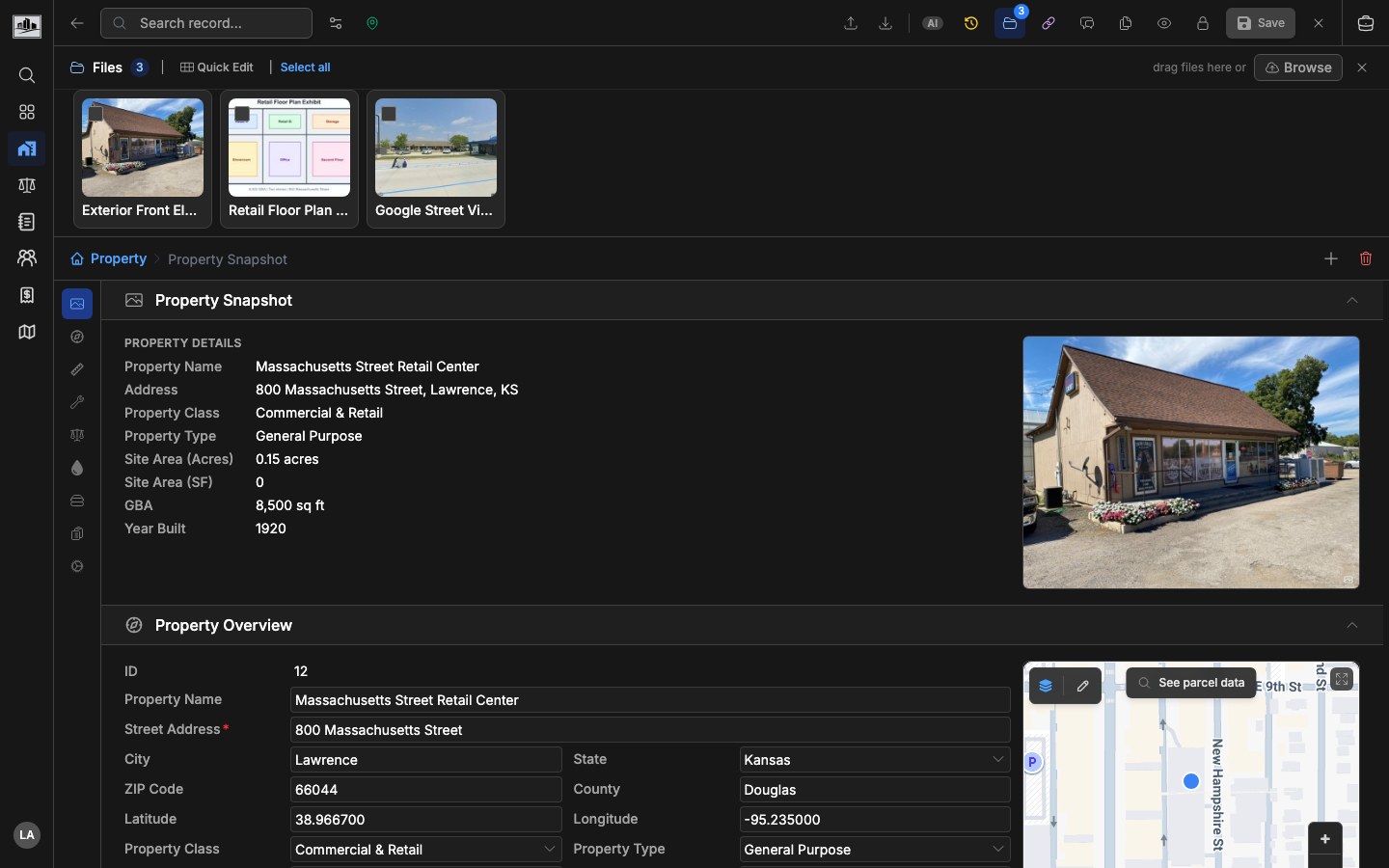
Uploaded files are stored with metadata including original name, display name, MIME type, size, storage provider, status, upload user, and timestamps.
Preview And Edit
Section titled “Preview And Edit”Click a file to open the preview modal. Images, videos, PDFs, and generic files use type-specific previews where available. The preview modal supports carousel navigation, download, rename, delete, rotation for images, and metadata review.
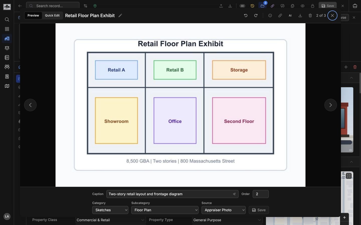
The Preview tab is best for reviewing one file at a time. For images, the metadata controls below the preview let you update the caption, category, subcategory, source, and report order without leaving the modal. Category, source, and order changes are saved with the save button; caption edits save when the field loses focus.
File links can open directly to a specific file by including the file ID in the page URL.
Quick Edit Photos
Section titled “Quick Edit Photos”Use Quick Edit from the file drawer or the preview modal’s Quick Edit tab when you need to clean up several inspection photos before report output. Quick Edit opens an image-only grid with the common photo fields exposed on each card.
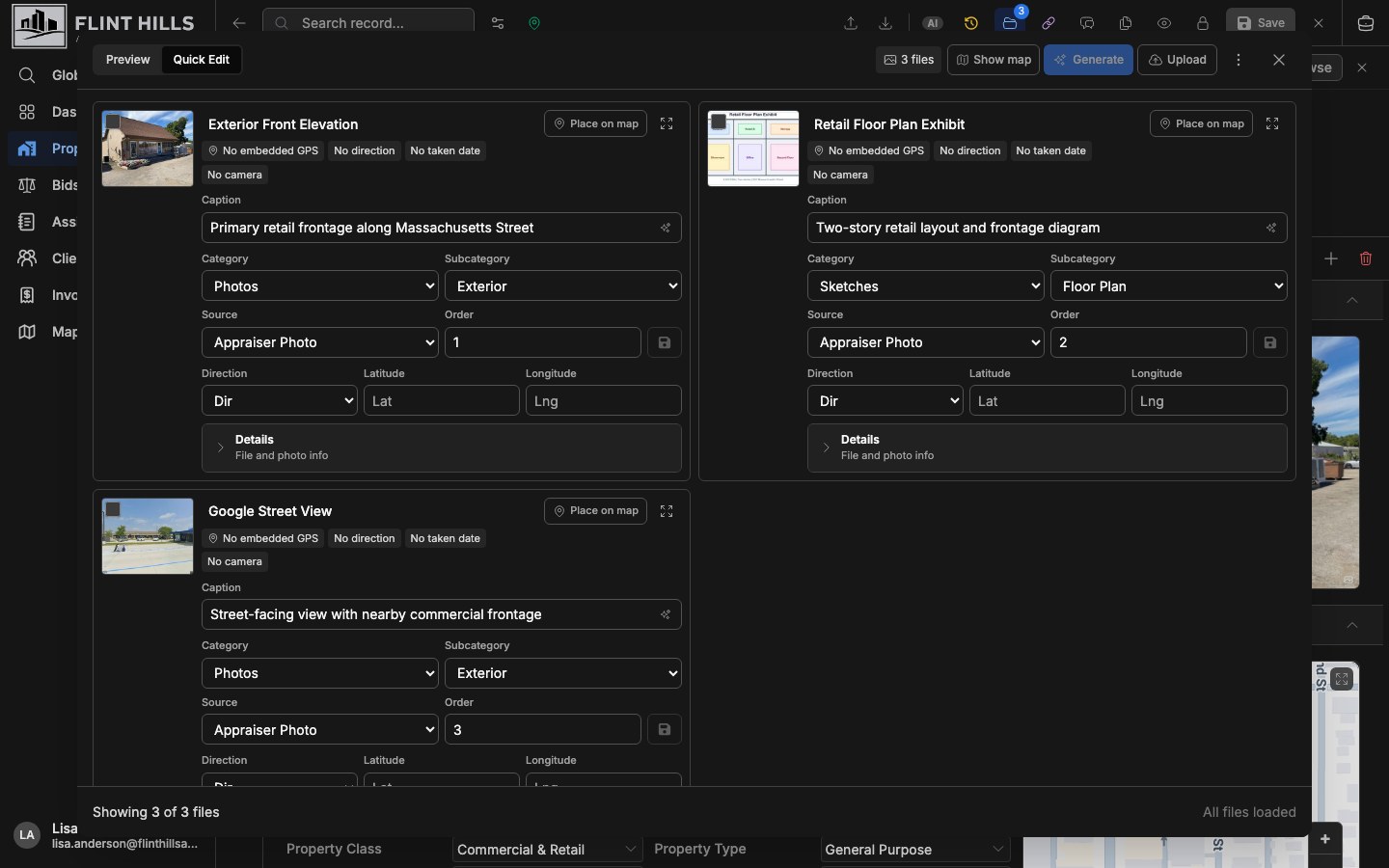
Each photo card supports:
- Display name edits.
- Caption edits, including AI draft caption generation when enabled.
- Category, subcategory, source, and report order.
- Direction selection using cardinal directions.
- Manual latitude and longitude entry.
- Quick preview from the card thumbnail or expand button.
- Details review for file metadata and inspection photo metadata.
Display name, caption, direction, and manual coordinate edits save from the field interaction. Category, subcategory, source, and report order are staged until you click the save button on the card.
The toolbar supports selecting photos, selecting all loaded photos, generating AI caption drafts for the selected photos, applying multiple generated drafts, uploading more photos, and deleting selected photos. Generated captions are drafts first; they do not replace saved captions until you apply an individual draft or use the apply-drafts action.
Edit Photo Locations
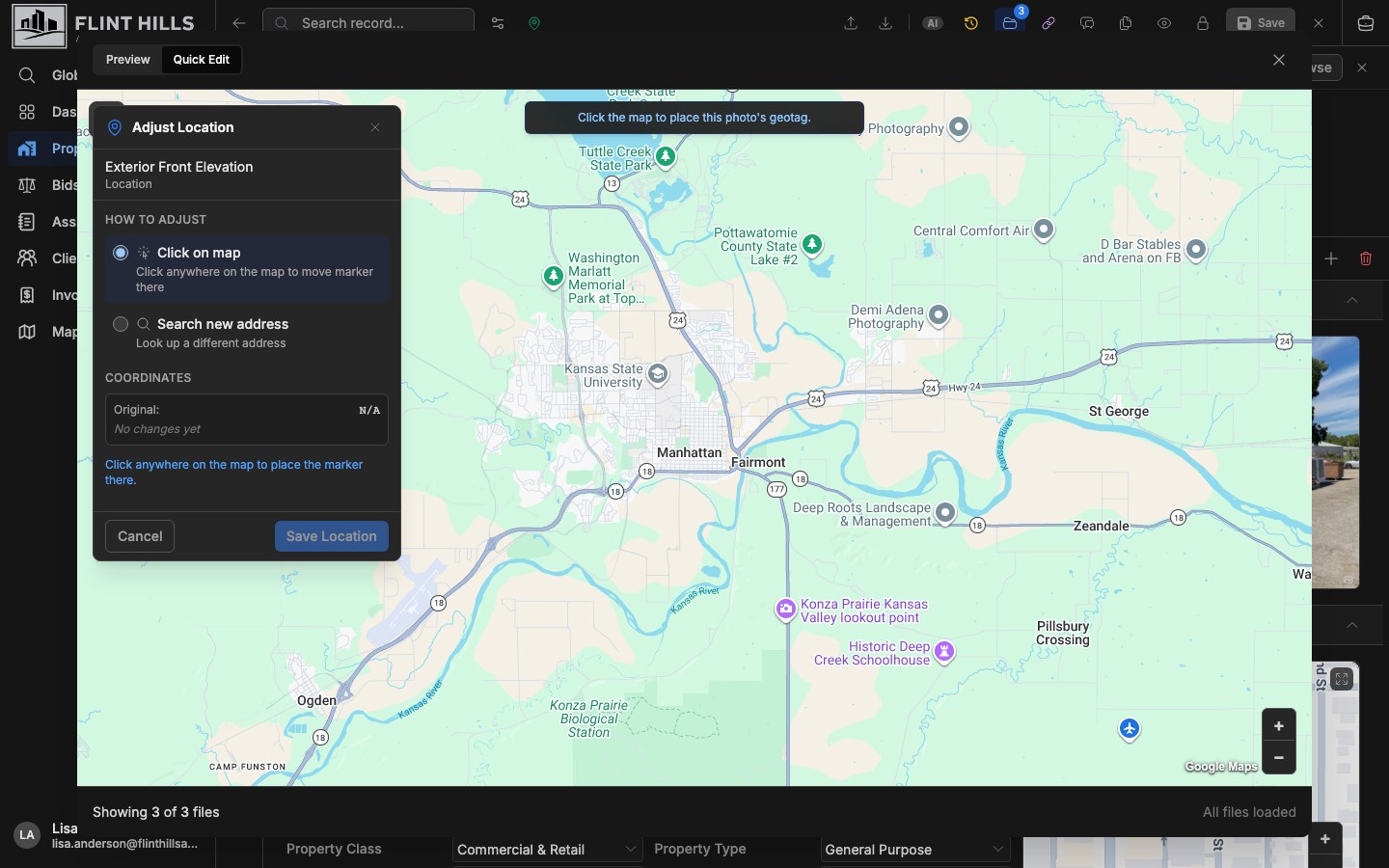
Section titled “Edit Photo Locations”Use Show map in Quick Edit to review geotagged photos beside the photo list. Photos with coordinates appear on the map, and direction metadata displays as a direction marker when available.
For photos without GPS data, use Place on map. For photos with existing coordinates, use Adjust geotag. The map editor lets you click a location or search for an address, then save the chosen coordinates back to the photo.
Work With Inspection Photos
Section titled “Work With Inspection Photos”Inspection photo tools are available for assignment and property workflows. When photos include GPS or direction data, the interface can show location and direction context and lets users update geotag information manually.
AI caption generation is available when the organization has the required AI feature enabled. If caption generation is unavailable, captions can still be entered and edited manually.
Related Features
Section titled “Related Features”- Assignments & Workflow for assignment report files.
- Property Database for property attachments.
- Office Add-in for inserting assignment media into Word.